Walking the King Charles III England Coast Path: North West Cumbria Map Booklet
This map booklet to the Cumbrian section of the England Coast Path contains detailed mapping for walking the route in either direction. With easy access at many points along the way, the Cumbrian section can be enjoyed as a trek of around 15 days or in shorter sections. Full route shown on 1:25,000 OS mapsMap booklet can be u......
fra 119,-
På lager i 2 butikker
Kjøp på nett
På lager
Frakt og levering
Fjernlager
Frakt og levering
Sammenligning av produkter
Her finner du de fire mest populære produktene i denne kategorien i en lignende prisklasse som det du ser på nå.

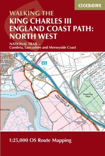
Walking the King Charles III England Coast Path: North West Cumbria Map Booklet
119,-

Produktinformasjon
Covering the northern section of one of England’s most ambitious long-distance trails, the King Charles III England Coast Path in Cumbria offers a rich and varied coastal walking experience. Stretching from Gretna on the Scottish border to Grange-over-Sands, this dramatic route traces the shores of the Solway Firth and the fringes of the Lake District, combining expansive estuaries, rugged shoreline and ever-changing coastal landscapes. The North West Cumbria Map Booklet is an essential navigation companion for anyone exploring this section of the trail. Compact yet highly detailed, it presents the full route on high-quality Ordnance Survey 1:25,000 mapping, ensuring accurate, easy-to-follow guidance whether you’re planning a multi-day adventure or enjoying shorter coastal walks. Full route coverage of the King Charles III England Coast Path National Trail across Cumbria on Ordnance Survey 1:25,000 mapsClearly highlighted route line with access points, coastal features, harbours and key locations between Gretna and Grange-over-SandsContinuous mapping presented in a single, easy-to-use booklet for travel in either directionLightweight and compact format, well-suited to carrying in changing coastal weather conditionsIdeal for both long-distance walkers and those planning shorter day walks A companion Cicerone guidebook is also available, providing in-depth route descriptions and planning guidance. You can also pair this booklet with the Lancashire and Merseyside Map Booklet to complete your North West England Coast Path collection. From expansive salt marshes and open tidal flats to historic ports and coastal viewpoints backed by mountain scenery, this section of the route highlights the quieter, wilder side of England’s coastline. With the Cumbria map booklet to hand, you can navigate confidently and experience this unique landscape at your own pace.
Spesifikasjon
Produkt
| Produktnavn | Walking the King Charles III England Coast Path: North West Cumbria Map Booklet |
| book typ | boker, hobby og fritid, fritid, friluftsliv |
Populære produkter
Pris og prishistorikk
Akkurat nå er 119,- den billigste prisen for Walking the King Charles III England Coast Path: North West Cumbria Map Booklet blant 2 butikker hos Prisradar. Sjekk også vår topp 5-rangering av beste bøker for å være sikker på at du gjør det beste kjøpet.
The Saragossa Manuscript (1965) / SaragossamanuskriptetWas Jesus God?The Epitome of Queen Lilavati (Volume 2)Team Brass: Brass Band Instruments
How the Nagas Were Pleased by Harsha & The Shattered Thighs by BhasaCat Box 100 Postcards by 10 ArtistsNatural Elegance Luxurious Mountain LivingNKJV Holy Bible, Super Giant Print Reference Bible, Blue Leathersoft, 43,000 Cross references, Red L
Mechanochemistry: Fundamentals, Applications and Future Faraday Discussion 241Iontronics: From Fundamentals to Ioncontrolled Devices Faraday Discussion FD246On Bataille and BlanchotSnap & Snuggle My Sleepy Sloth