
Imray 2500 Chart Pack
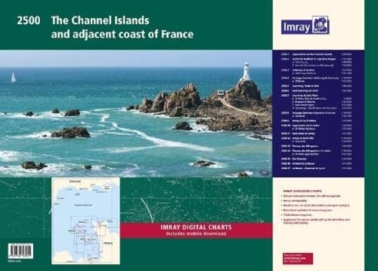
A convenient A2 format chart pack of the Channel Islands and the adjacent coast of France provided in a sturdy plastic wallet. This fully revised edition includes the latest official UKHO Digital, combined with additional information sourced from Imray's network to make it ideal for small craft. The chart pack includes a......
fra 819,-
På lager i 1 butikker
Kjøp på nett
På lager
Frakt og levering
Sammenligning av produkter
Her finner du de fire mest populære produktene i denne kategorien i en lignende prisklasse som det du ser på nå.


Imray 2500 Chart Pack
819,-


Produktinformasjon
A convenient A2 format chart pack of the Channel Islands and the adjacent coast of France provided in a sturdy plastic wallet. This fully revised edition includes the latest official UKHO Digital, combined with additional information sourced from Imray's network to make it ideal for small craft. The chart pack includes all the navigational charts and tidal Digital for passage, approach and mooring. This edition has been reschemed to show passage from as far East as Saint-Vaast-la-Hougue and Barfleur. The harbour plan of Port de Chantereyne (Cherbourg) has been extended so show greater approach detail. There has been general updating throughout. This product is also available wiro bound, please use code IC2500-4W. 2500.1 Approaches to the Channel Islands 1: 500 000 WGS 84 2500.2 Pointe de Barfleur to Cap de la Hague 1: 155 000 WGS 84 Plans Cherbourg (1:40 000), Port de Chantereyne (Cherbourg) (1:10 000) 2500.3 Alderney & Burhou 1: 25 000 WGS 84 Plan Alderney Harbour (1:12 500) 2500.4 Passages Between Alderney & Guernsey 1: 150 000 WGS 84 Plan Diélette (1:15 000) 2500.5 Guernsey, Herm & Sark 1: 60 000 WGS 84 2500.6 East Guernsey & Herm 1: 25 000 WGS 84 2500.7 Guernsey & Sark Plans 1: various WGS 84 Plans St Peter Port & Havelet Bay (1:6000), Beaucette Marina (1:10 000), Sark Anchorages (1:25 000), Guernsey - South Coast Anchorages (1:25 000) 2500.8 Passages between Guernsey & Jersey 1: 150 000 WGS 84 Plan Carteret (1:22 500) 2500.9 Jersey & Les Écrehou 1: 75 000 WGS 84 2500.10 Approaches to St Helier 1: 30 000 WGS 84 Plan St Helier Harbour (1:15 000) 2500.11 East Coast of Jersey 1: 25 000 WGS 84 2500.12 Jersey to Granville 1: 150 000 WGS 84 Plan Granville (1:30 000) 2500.13 Plateau des Minquiers 1: 50 000 WGS 84 2500.14 Plateau des Minquiers to St-Malo 1: 150 000 WGS 84 Plan St-Malo Approaches (1:55 000) 2500.15 Îles Chausey 1: 25 000 WGS 84 2500.16 St-Malo & La Rance 1: 15 000 WGS 84 2500.17 La Rance - Cancaval to Lyvet 1: 25 000 WGS 84 A voucher code to download ID20 Imray English Channel charts into Imray Navigator (our app for iPad, iPhone and Android) is included with this chart pack.
Spesifikasjon
Produkt
| Produktnavn | Imray 2500 Chart Pack |
| book typ | Reise |
Populære produkter
Pris og prishistorikk
Akkurat nå er 819,- den billigste prisen for Imray 2500 Chart Pack blant 1 butikker hos Prisradar. Sjekk også vår topp 5-rangering av beste bøker for å være sikker på at du gjør det beste kjøpet.