Pennine Way South Edale to MiddletoninTeesdale
Now printed on 100% waterproof and practically indestructable polyethelene paper. Weighing half the weight of a laminated map this updated map from Edale to Middleton-in-Teesdale is the Southern part of the popular Pennine Way. The Pennine Way is a National Trail.It follows the backbone of England from the Peak District to th......
fra 229,-
På lager i 1 butikker
Kjøp på nett
Fjernlager
Frakt og levering
Sammenligning av produkter
Her finner du de fire mest populære produktene i denne kategorien i en lignende prisklasse som det du ser på nå.

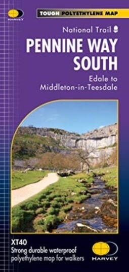
Pennine Way South Edale to MiddletoninTeesdale
229,-

Produktinformasjon
Now printed on 100% waterproof and practically indestructable polyethelene paper. Weighing half the weight of a laminated map this updated map from Edale to Middleton-in-Teesdale is the Southern part of the popular Pennine Way. The Pennine Way is a National Trail.It follows the backbone of England from the Peak District to the Scottish borders. It is one of the toughest UK long distance footpaths, and forms part of the European Footpath Network. The Pennine Way was Britain's first National Trail, opened in 1965.Just 2 HARVEY maps cover the whole 268-mile route. Each covers a section of the Way suitable for a comfortable week of walking. Each starts and finishes near public transport.
Spesifikasjon
| Produkt | |
|---|---|
| Produktnavn | Pennine Way South Edale to MiddletoninTeesdale |
| book typ | Reise |
Populære produkter
Pris og prishistorikk
Akkurat nå er 229,- den billigste prisen for Pennine Way South Edale to MiddletoninTeesdale blant 1 butikker hos Prisradar. Sjekk også vår topp 5-rangering av beste bøker for å være sikker på at du gjør det beste kjøpet.
International Influence, Domestic Regimes, and Autonomy in AsiaPolycentricity and Public PolicyHarriet de Onis and the Translation of Latin American LiteratureTeaching Metal
Existential Aesthetics99 Moments That Defined Rock & RollBio-control Agents for Sustainable AgricultureChaos and Its Applications