The Changing Electoral Map of England and Wales
The book offers a definitive account of how the geography of voting at British general elections has changed over the last half century. It shows how social and economic trends and changes in the appeal of parties to different groups of people have led to a reordering of the geography of party support....
fra 399,-
På lager i 2 butikker
Kjøp på nett
Fjernlager
Frakt og levering
På lager
Frakt og levering


Sammenligning av produkter
Her finner du de fire mest populære produktene i denne kategorien i en lignende prisklasse som det du ser på nå.


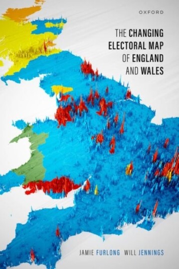
The Changing Electoral Map of England and Wales
399,-


Produktinformasjon
The 2019 British general election saw a dramatic redrawing of the electoral map, with the Labour Party losing seats to the Conservatives in former heartlands in the North of England and Midlands. Yet this had been a long-term shift, with the opposite trend occurring in major cities and university towns, where Labour''s support has been increasing. What has driven these changes in electoral geography? Why do they matter? This book offers a definitive account of the changing electoral geography of England and Wales over the past half century. Jamie Furlong and Will Jennings argue that long-term trends in social and economic structure have significantly altered the spatial distribution of voters and, combined with changes in the parties'' appeal to those voters, have led to a gradual, though recently accelerating, realignment of the geographical basis of electoral competition. Constituency-level analysis of voting at general elections between 1979 and 2019 reveals a swing from Labour to the Conservatives in demographically ''left behind'' areas (areas with largely white, working-class populations and lower levels of educational attainment), while Labour''s support has remained stable in areas characterized by high levels of economic deprivation and insecure employment. Areas that have experienced improvements in their socioeconomic condition - typically cities where Labour have inefficiently stacked up votes - have swung towards Labour, whereas areas characterized by economic and population decline have swung towards the Conservatives. Spatial analysis reveals clusters of seats where each party has more support than expected based on sociodemographic composition - places where, in short, place matters. In Merseyside, Labour''s vote is much higher than would be predicted by demographics, while this is similarly the case for the Conservatives in Lincolnshire and parts of the West Midlands. But what makes these areas distinctive? We present qualitative case studies for Merseyside and Lincolnshire to identify the place-based, contextual factors that help explain their unusual political characteristics. The book argues for the need to recognize the importance of people, places, and parties in shaping the geography of electoral outcomes.
Spesifikasjon
| Produkt | |
|---|---|
| Produktnavn | The Changing Electoral Map of England and Wales |
| book typ | boker, fagboker, samfunnsvitenskap, statsvitenskap politikk og forvaltning |
FAQ
Black Friday er fredag 27. november 2026. Sammenlign prisen på The Changing Electoral Map of England and Wales hos flere butikker, og sjekk prishistorikken der den er tilgjengelig. Kontroller at tilbudene gjelder samme modell og variant, og ta med fraktkostnaden når du sammenligner.
Populære produkter
Pris og prishistorikk
Akkurat nå er 399,- den billigste prisen for The Changing Electoral Map of England and Wales blant 2 butikker hos Prisradar. Sjekk også vår topp 5-rangering av beste bøker for å være sikker på at du gjør det beste kjøpet.
Markt und StaatVorstandsvergutung als Mechanismus der Corporate GovernanceElternschaft und WohlbefindenGemeinnützige Krankenhäuser im Gemeinnützigkeitsrecht und im europäischen Beihilferecht
Kapitaleinkunfte und SpekulationsgeschafteSteueroptimale VerlustnutzungZusammenDenkenPerspektiven auf sexualisierte Gewalt
Kundigung des Bauvertrages nach AnspruchenWald in der Vielfalt moglicher PerspektivenOhne Dop(amin)e ist alles doofLand Remediation and Management: Bioengineering Strategies