Modeling Geoenvironmental Hazards and Resilience Geospatial and AI coupled approaches
In today's world the problems of geo-environmental hazards are gradually increasing. With increasing effects of anthropogenic interference and erratic behaviours of climatic parameters such hazards have increased many folds in all over the world. Landslide, flash flood, cyclone, heat and cold wave, soil erosion, drought,......
fra 1 799,-
På lager i 2 butikker
Kjøp på nett
Forhåndsbestill
Frakt og levering
På lager
Frakt og levering
Sammenligning av produkter
Her finner du de fire mest populære produktene i denne kategorien i en lignende prisklasse som det du ser på nå.


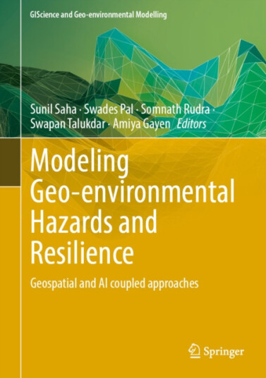
Modeling Geoenvironmental Hazards and Resilience Geospatial and AI coupled approaches
1 799,-


Produktinformasjon
In today's world the problems of geo-environmental hazards are gradually increasing. With increasing effects of anthropogenic interference and erratic behaviours of climatic parameters such hazards have increased many folds in all over the world. Landslide, flash flood, cyclone, heat and cold wave, soil erosion, drought, forest fire, land degradation etc. are some important geo-environmental hazards that have caused large scale property and life losses and degradation of the natural environment. These hazards amid the climate change scenario often create barrier against economic development in many countries, especially developing countries where most of the people are engaged in agricultural activities. It is very challenging task for the planners to formulate sustainable plans for mitigating the hazards and continuing socio-economic development. In this situation, first and foremost task is to scientifically model the geo-environmental hazards, its socio-ecological consequences. It is possible based on the advanced geospatial technologies. Advanced geospatial technology has opened up new dimension for handling the different l hazards in more sophisticated way. Integration of remote sensing-Geographic Information System (RS-GIS) tools coupling with advanced machine learning approaches make it easy to inventory and characterizing its behavior with greater precision. SAR, global navigation satellite system, light detection and ranging, Quickbird, SPOT 5, Google Earth Engine, and others can also help in this process. Different advance machine learning and deep learning algorithms may be used for assessing the susceptibility, risk and vulnerability of different hazards. The spatial models that can help to explain geo-environmental hazards, vulnerabilities will be used and compared in this book. This book focuses on how diverse machine learning models, as well as their ensemble forms and deep learning models, can optimize hazard modeling for the well-being of the environment and society. Modeling risk resilience in order to develop sustainable socio-ecological system is also very vital. It also compares the accuracy of traditional statistical and machine learning methods and advanced machine learning methods. It addresses the effects different natural hazards and ways for reducing the impact of these.
Topplisten: Other Brand Bøker
Spesifikasjon
| Produkt | |
|---|---|
| Produktnavn | Modeling Geoenvironmental Hazards and Resilience Geospatial and AI coupled approaches |
| Merke | Other Brand |
Populære produkter
Pris og prishistorikk
Akkurat nå er 1 799,- den billigste prisen for Modeling Geoenvironmental Hazards and Resilience Geospatial and AI coupled approaches blant 2 butikker hos Prisradar. Sjekk også vår topp 5-rangering av beste bøker for å være sikker på at du gjør det beste kjøpet.
Resource Extraction and Contentious StatesFrom Exploitation to EmpowermentEngine Exhaust ParticulatesGrenfell Tower
130 Years of Medicine in Hong KongNeue Wege zur Durchsetzung des VerbraucherrechtsThe Politics of Nuclear Energy in ChinaGrand Challenges in Marine Biotechnology
Imaging in Pediatric OncologyHand and Wrist Injuries In Combat SportsWage-Led GrowthFrom Big Data to Intelligent Data